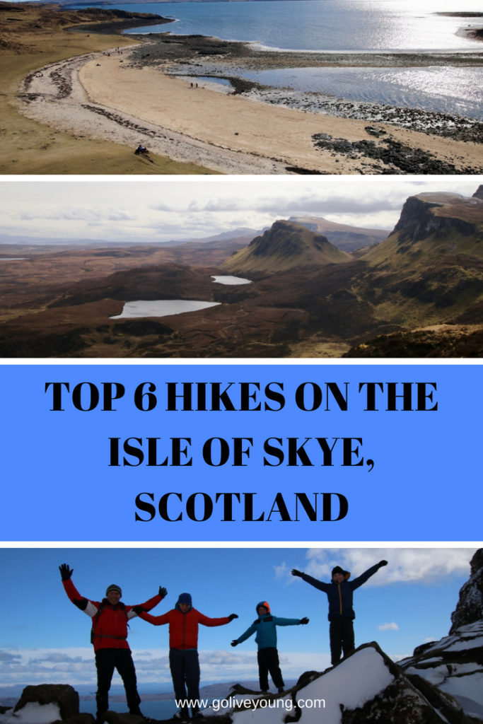
Skye has long been a mecca for hardy hillwalkers and climbers attracted by the Alpine peaks of the Cuillin, the most challenging mountains in Britain. However, there are scores of walks at all levels, taking in the stunning scenery and dramatic landscapes Skye boasts. As a family we love spending time outdoors and Skye is the perfect outdoor playground. Read on to discover our top six family friendly hikes on Skye.
THE OLD MAN OF STORR
Distance: 4.5km
Time: 2 hours
Terrain: Well-made paths, steep, sometimes muddy, signs warning of dangers of rock fall
Level of difficulty: Moderate. Appropriate for anyone who is relatively fit. Our children had no issues, even though there was snow on the ground, and they were 9, 11 and 14 at the time of hiking.
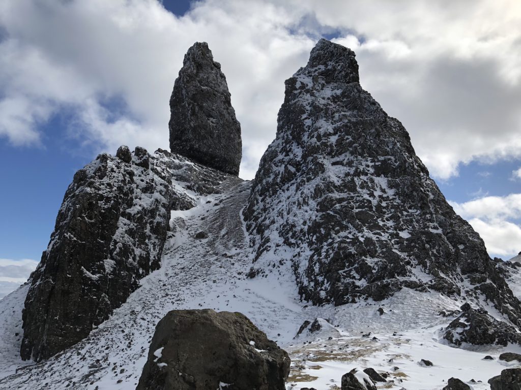
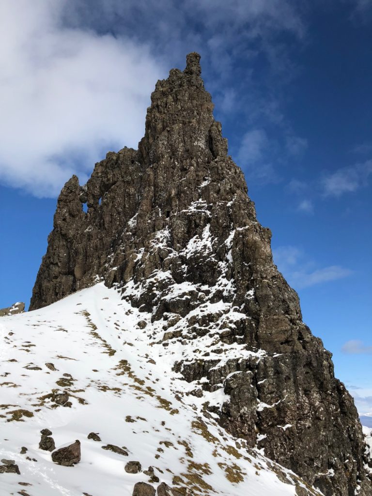
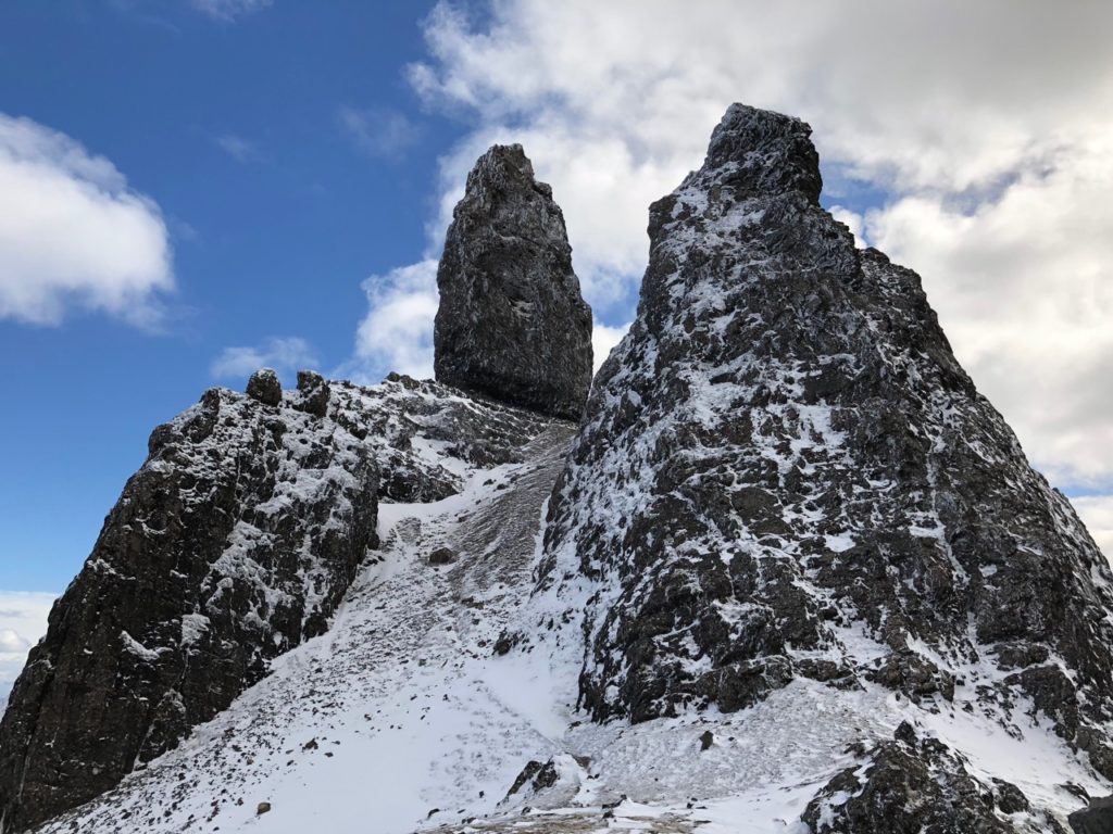
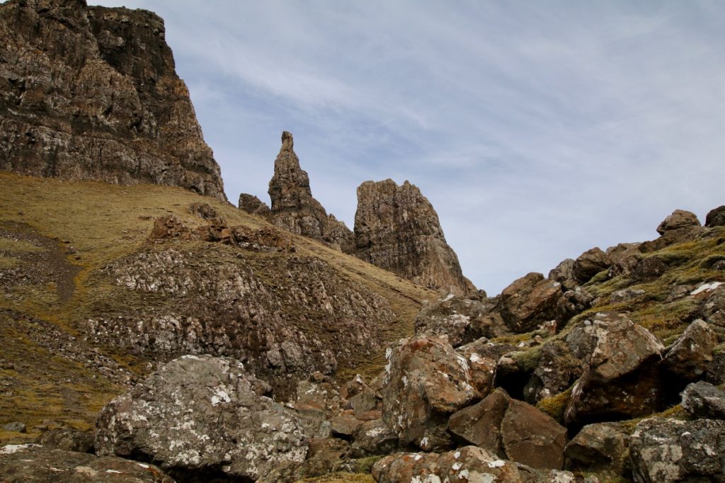
The most popular walk on Skye, the iconic pinnacle of the Old Man of Storr stands guard over the Sanctuary, a whole array of fantastic rock formations beneath the towering cliffs. This walk climbs on a good path to give everyone the chance to explore this remarkable place.
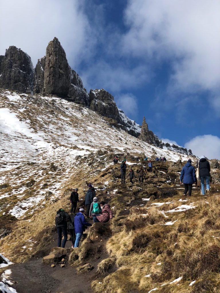
From the busy car park on he A855 Portree to Staffin road, take the path which heads through the gate and uphill. The path twists up through the recently felled area, before climbing more steeply and becoming rockier. Keep plodding uphill until you reach a gate with an intimidating warning sign! Go through the gate and continue uphill, getting ever closer to the Old Man of Storr.
The path forks and you can take either the left or right fork to make a loop around the Old Man. We took the right hand fork, passing between the Needle (a jagged tower with two holes cut through it, also known as the Cathedral) and the Old Man. Pick our way around fallen rocks beneath the towers.
Continue on around the Old Man into the Sanctuary, a hidden valley encircled by amazing formations. A warning sign highlights the danger of rock falls. This area is certainly best avoided after heavy rain.
Continue to circle the Old Man, before beginning your descent. The Old Man of Storr was first climbed in 1955 by Don Whillans who described the brittle and lose surface of the pinnacle as like trying to climb up porridge!
Read Also: Hiking the Old Man of Storr on the Isle of Skye
RUBHA NAM BRATHAIREAN (BROTHER’S POINT)
Distance: 3.5 km
Time: 1.5 hours
Terrain: Path with steep drops
Level of difficulty: Moderate. Appropriate for those that are relatively fit and don’t mind a bit of a scramble. Not for young children as there are steep drops down to the sea.
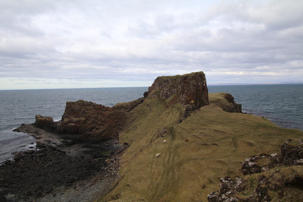
Rubha nam Brathairean is a dramatic rocky peninsula jutting out into the sea. It gives great coastal views up to Kilt Rock and Mealt Falls, and across o the islands of Rona and Raasay.
At Cuulnacnoc, on the eastern side of the Trotternish Peninsula, there is parking in a lay-by, just north of the Sky Pie Café and Glenview B&B. Head downhill a short distance on the road, before seeing the sign for Rubha nam Brathairean (Gaelic for Brother’s Point) and taking a left turn towards the coast. Pass through a farm gate and continue on the path until you pass a renovated blackhouse. Beying this, take the path marked ‘to the shore’ which descends across grazing land towards the sea.
At the coast, turn right across the pebbly shore. Continue up the grassy bank beyond and cross an area of boggy grass to follow the low cliff edge to the point. The path soon reappears as it crosses a steep slope above a sea inlet. Emerge onto a lovely falt grassy area with great views along the coast taking in Kilt Rock to the north.
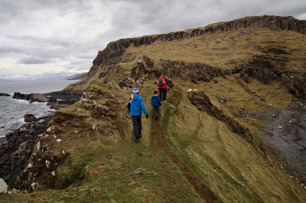
Follow the path along the side of the steep ridge which leads out towards the point. The path climbs very steeply over Dun Hasan, the site of an Iron Age fort. The route is easy to follow but may require some scrambling.
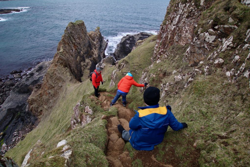
You can then follow the path down the other side – just as steep, and out to the point.
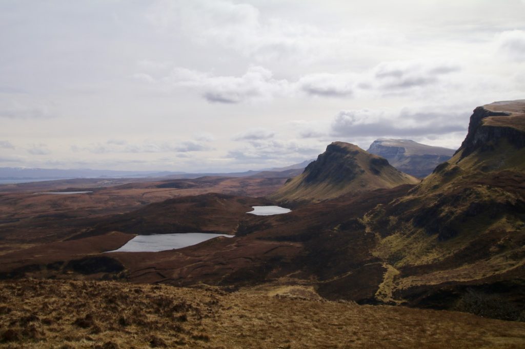
THE QUIRAING
Distance: 4.5 km
Time: 2 hours
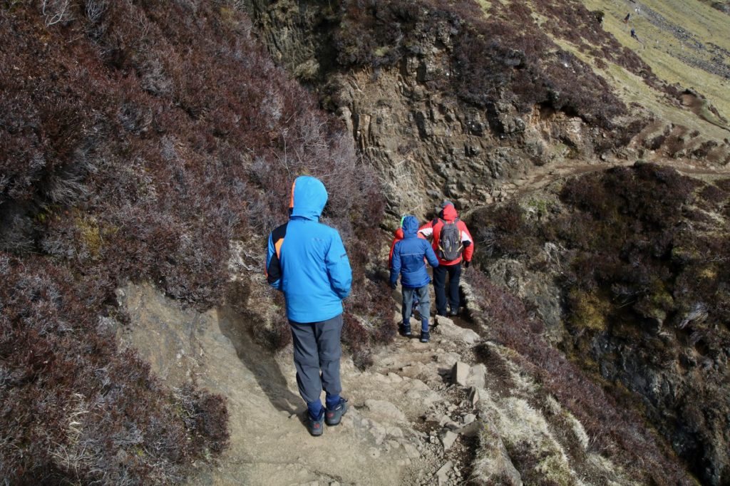
Terrain: Rocky path with steep drops
Level of difficulty: Moderate. Appropriate for anyone who is relatively fit. Not suitable for young children as there are a number of steep drops down the mountainside. Our children had no issues and they were 9, 11 and 14 at the time of hiking.
This spectacular walk takes you into the heart of the Quiraing, a fantastic landscape of rocky pinnacles and cliffs.
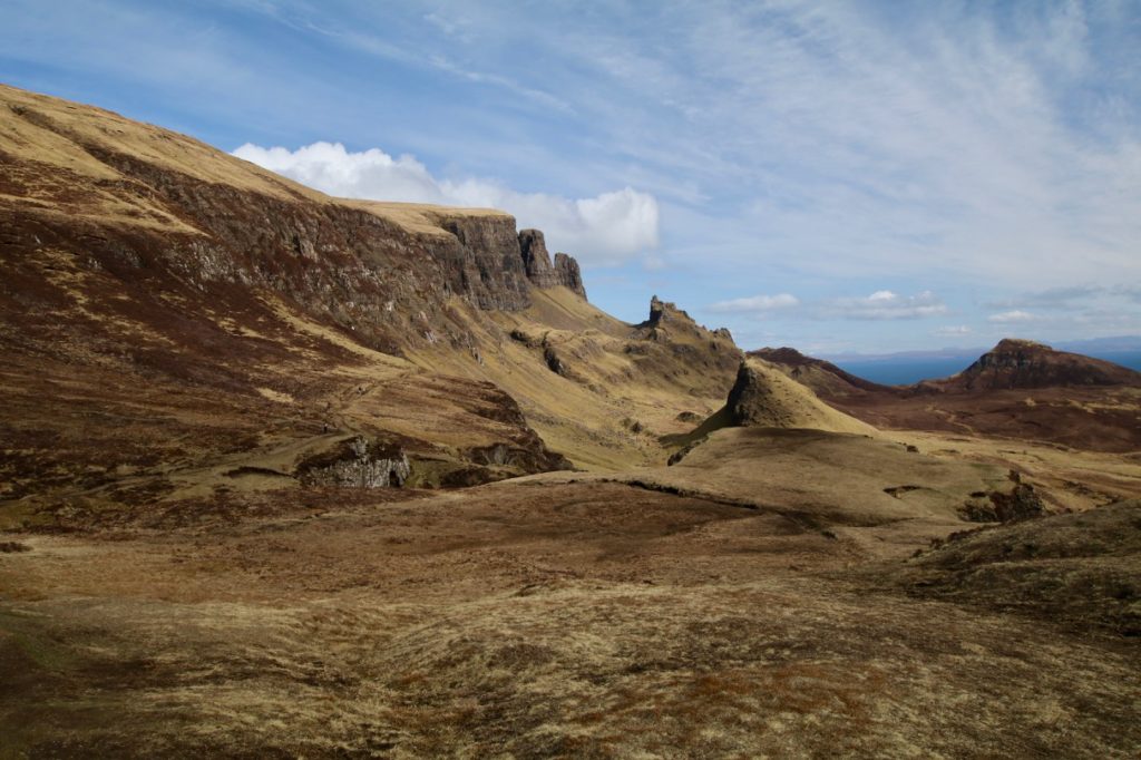
Start at the parking area at the top of the pass on the Staffin to Uig road. Here you are at the edge of the escarpment that makes up the Trotternish Ridge. A 36km eroding landslide that creates an impressive geographic divide across the northern peninsula of the island. Cross the road and take the flat path on the other side. Follow this path as it heads towards the pinnacles that make up the landscape of the Quiraing. The path traverses a steep slope and crosses a small gully with a short rocky section that requires care.
The path continues to contour along the slope and soon the impressive rock feature of the Prison comes into view. Continue on the path slightly uphill into the gap between the Prison and the main mass of the Quiraing. High up ahead is the Needle, a prominent detached pinnacle.
Beyond the Needle, but out of sight, is the Table, a flat grassy area in the middle of the Quiraing surrounded by rocky towers. Local folklore claims that people used to hide cattle here when raiders were spotted. Reaching the Table involves heading up and down some very steep, eroded ground and requires great care. We didn’t do it on this occasion as it was a freezing cold day and everyone wanted to head back to the car!
Read Also: Hiking the Quiraing on the Isle of Skye
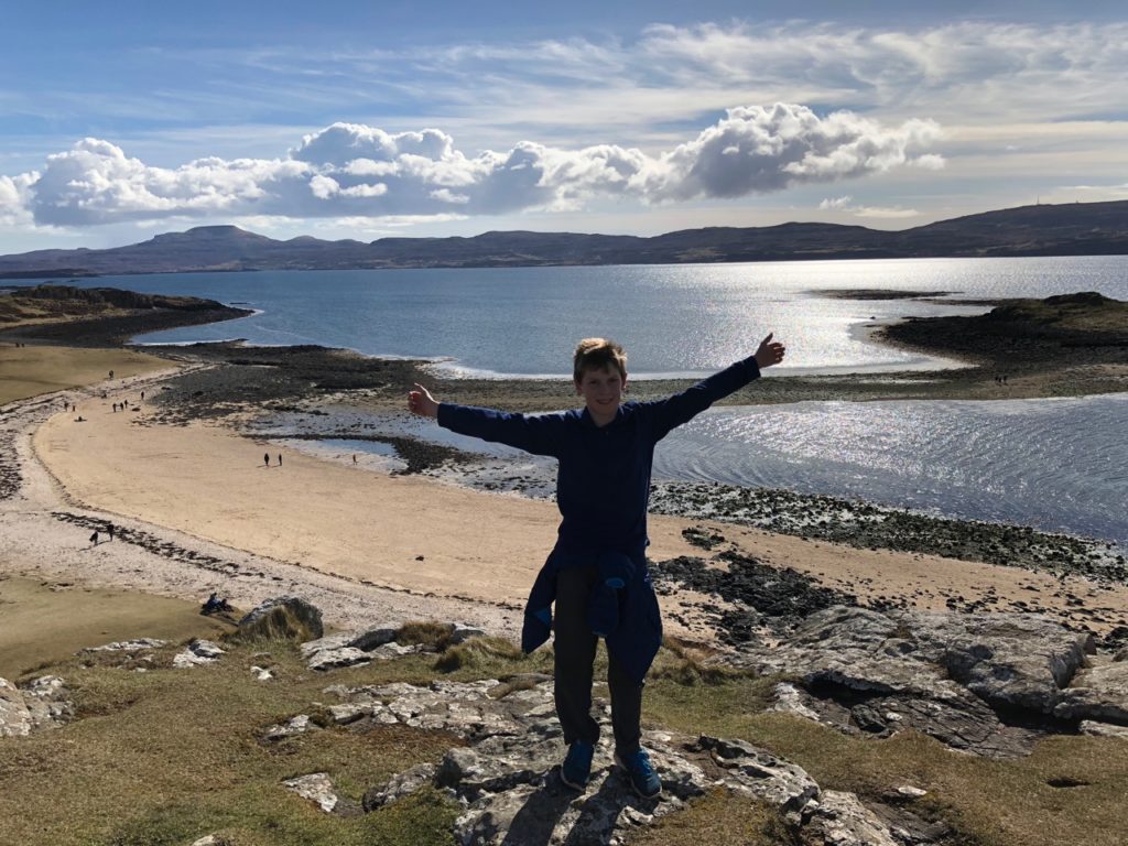
CLAIGAN CORAL BEACHES
Distance: 4 km
Time: 1 hour 30 mins
Terrain: Grassy path
Level of difficulty: Easy. Suitable for everyone.
A taste of the Caribbean on Skye with brilliant white beaches.
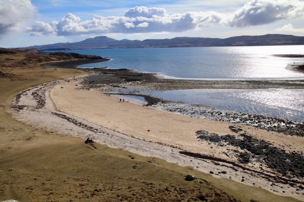
The walk starts at the car park at the road end of Claigan, northwest of Dunvegan.Take the track from the bottom of the car park towards the sea. Follow it as it bends and runs parallel to the coast. Soon a pebbly bay is reached. The track heads to the right here but instead continue on a grassy footpath aiming for a gap in the drystone wall. After passing the wall, carry on over the rise and when you reach the top there is a view across to the coral beaches.
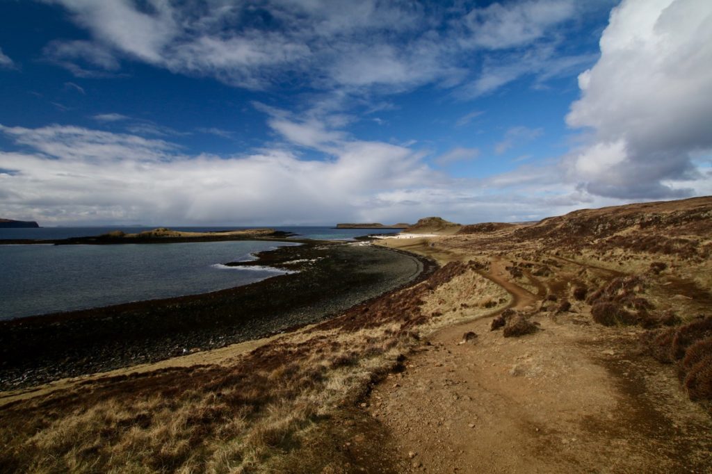
Head straight for the beaches.The sand is actually not made from coral at all, but from maerl, the calcified remains of a type of seaweed that grows off the coast.
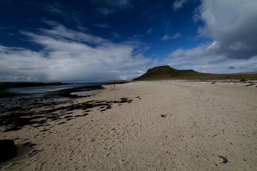
It is well worth ascending the small flat topped hill behind the beaches for extensive views.
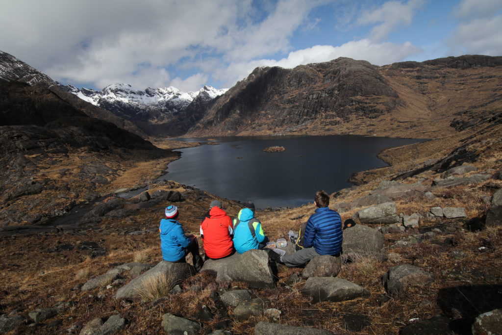
LOCH CORUISK
Distance: 7 km
Time: 3 hours 30 mins
Terrain: Very boggy, rough path, river crossings
Level of difficulty: Moderate.
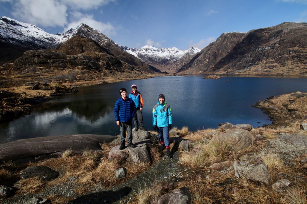
A fantastic walk into the heart of the Cuillin mountains without any need to scale the heights. If the full circuit (7 kilometres) is too much, it is still worth doing the first section for the awe-inspiring surroundings. This was the best view we experienced while we were on the Isle of Skye. A perfect spot for a picnic lunch…
From Elgol you need to take a boat trip out to Loch Coruisk, an amazing loch encircled by the high mountains of the Cuillins. We went with Misty Isle boat trips, who we would definetely recommend. Tickets generally need to be booked in advance and you should ensure that the timetables will leave you enough time to complete the walk. If you are doing the full circuit you will typically need to go out on the morning boat and return on the afternoon boat.
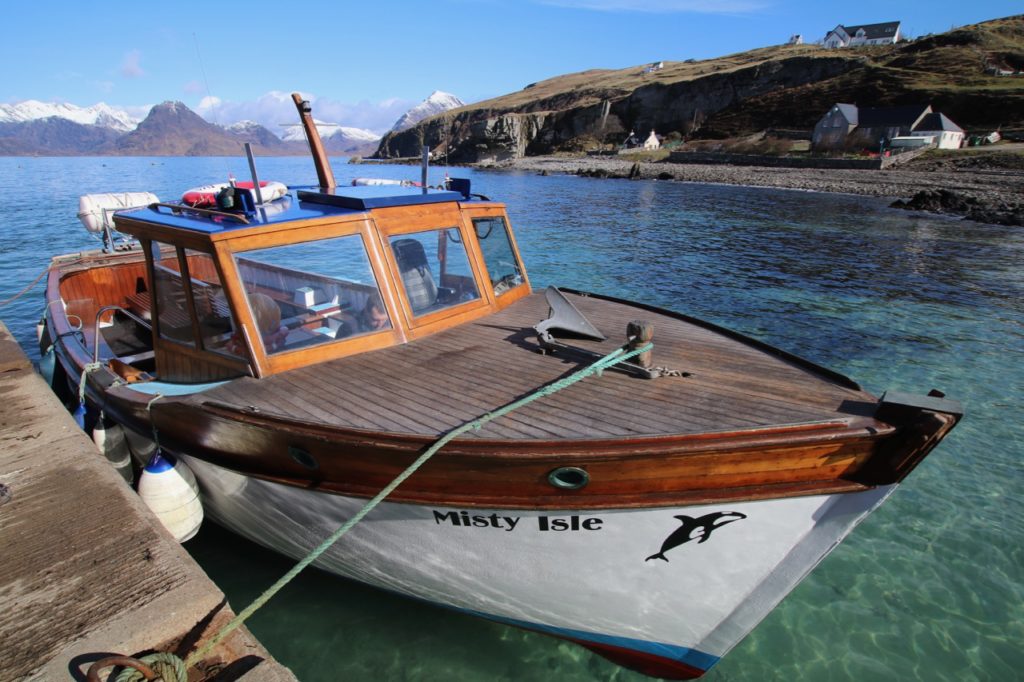
The boat trip itself is totally worthwhile with wonderful views of the Cuillins and surrounding islands. Seals are usually seen, and frequently porpoise can be sighted. The boat moors at a landing stage in Loch na Cuilce, in the shadow of the mountains.
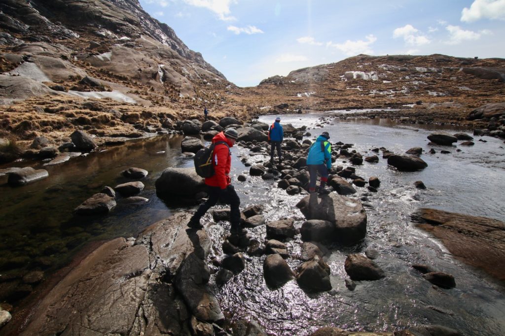
Begin the walk by ascending inland. The Scavaig, one of the shortest rivers in Scotland, cascades into the sea over rock slabs to your right. Continue along the river until you see Loch Coruisk. Cross the river using the stones.
The path then climbs a short distance to give the most magnificent view of Loch Coruisk – one of the best views in Scotland. Follow the path a little way before heading back down to the shore.
Follow the path around the loch, sticking close to the shore, crossing a number of small rivers on stepping stones. The going can be very boggy, particularly after rain.
Eventually, the end of the loch is reached and the path down to the waiting boat for the return to Elgol.
Read Also: A Boat Trip to Loch Coruisk on Skye
FAIRY POOLS
Distance: 2.5 km
Time: 1 hour
Terrain: Path
Level of difficulty: Easy. Suitable for everyone.
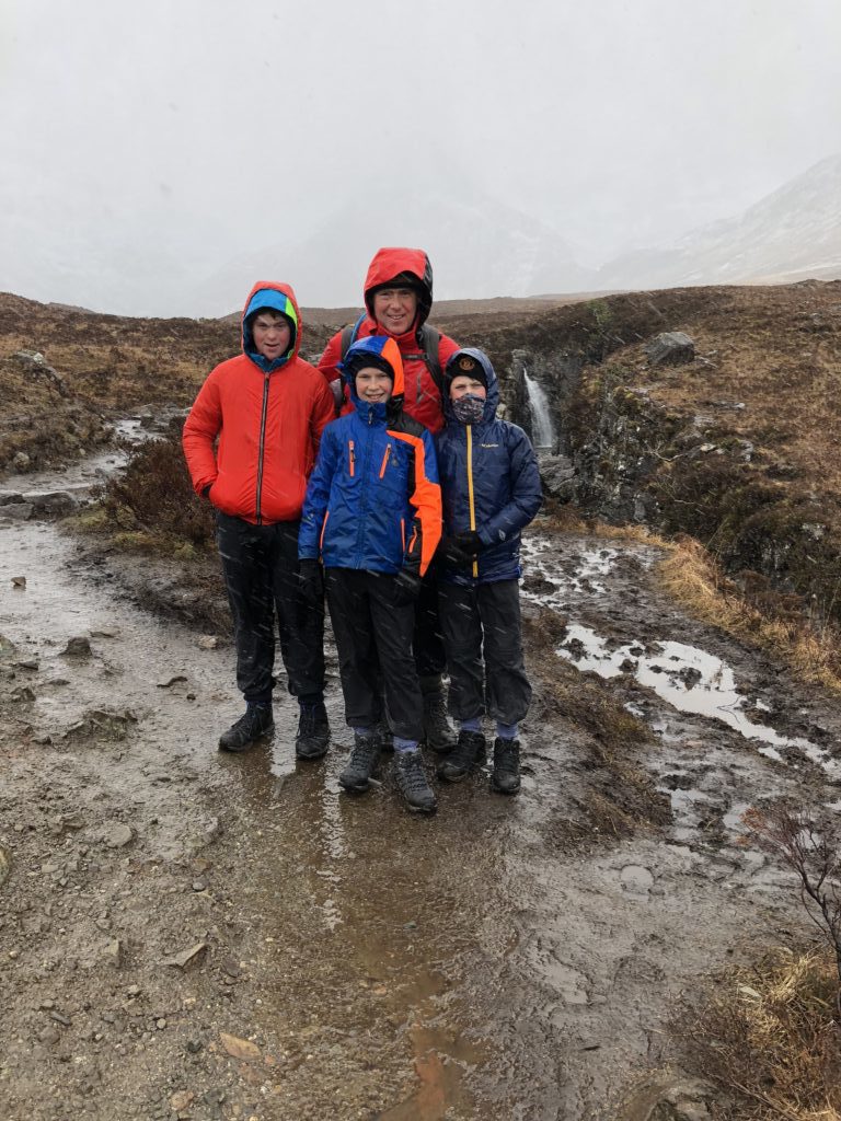
This walk takes in a series of beautiful, icy clear pools and cascading falls. Legend states that intrepid fairies may bathe here! The pools are very popular with visitors so expect them to be busy during the tourist season. Our visit was during April and unfortunately we didn’t see the Fairy pools at their best, instead during a blizzard of sleet and rain – we didn’t stay long!
The walk starts at the Fairy Pools car park which is on the right-side of the road as you near the bottom of the hill heading to Glen Brittle. Cross the road from the car park and head down the obvious path. Cross stepping stones over a small burn to reach the wider Allt Coir a’Mhadaidh further on. This crystal clear burn tumbles through an enchanting series of pools, underwater arches and circular bowls carved into the rock by the water.
READ ALSO:
Top 12 Things To Do on the Isle of Skye With Kids
Have you hiked on the Isle of Skye? What was your favourite hike?
14 Comments.
These walks look and sound amazing. I’m really looking forward to taking my kids on more adventurous walks (they’re 6 and 4 at the mo). I’ll definitely pin this for future reference!
Skye took our breath away, it was so beautiful, and the best way to explore and get right in amongst the wonderful scenery, was hiking.
These looks great. I’ve been to the Isle of Skye a few times but just sat in the pub and drank whisky the whole time! Looks like I should get out and try some of the hikes instead.
You should indeed! The scenery is just stunning, particularly if you get god weather.
This post brought back some lovely memories of my trip to Skye some time ago. It’s definitely one of the most beautiful places to go hiking in! #FarawayFiles
So glad you agree. We loved Skye, such stunning scenery.
I am so bookmarking this! I cannot wait to take my boys hiking here. Have loved following your photos on insta from this trip. #FarawayFiles
Thanks Jenny. Skye is a definite must visit in the UK for breathtaking scenery.
Skye is on my bucket list. Such a unique place and really off the beaten path. The views captured by your photos show the effort is worth it. #FarawayFiles
Thanks Deborah. Skye is a definite must visit in the UK.
So glad I found this – we want to get up to Scotland next year.
I hope you get there Kate and are as lucky as us with the weather!
What stunning photos! Hiking is such a fabulous way of enjoying the beautiful scenery and Skye looks positively otherworldly in some of these shots. You’re definitely inspiring me to head north! Thanks for sharing on #FarawayFiles
It’s worth a trip north Clare. Just need to get lucky with the weather!